On the open sea, with no landmarks in sight, the question of where the ship is has no obvious answer. Coastal voyages could follow the line of the shore, but crossing an ocean demanded a different kind of knowledge. Two problems stand out. One was keeping a heading, knowing which way to go. The other was finding a position: how far the ship had come and where it stood in relation to its destination. Errors of position cost lives, cargoes and ships for centuries.
The solutions did not come from a single instrument or a single culture. They drew on orally transmitted lore, astronomy, geometry, metalworking and clockmaking.
How it works
Latitude, longitude and heading
Latitude is the distance north or south of the equator. It can be found by measuring the height of a celestial body above the horizon. In the northern hemisphere, the height of the Pole Star gives a close estimate, and the noon Sun, combined with tables of its changing position through the year, gives a more exact one. Longitude, the distance east or west of a reference meridian, is harder, because the Earth rotates and the sky shifts with the hour. The solution is to compare local time, found from the Sun, with the time at a reference place. Each hour of difference equals 15 degrees of longitude. That demands either a reliable clock aboard or another astronomical method for knowing the reference time.
Heading is the direction of travel. With no fixed references, a navigator uses dead reckoning: from the heading, the speed and the time elapsed, the ship's position is estimated from the last known point, adjusted for what can be guessed about currents and wind.
The instruments
- Astrolabe. A metal disk with an angular scale and a rotating sighting bar, the alidade, used to measure the height of a star or the Sun. The planispheric astrolabe, a complex astronomical calculator, came out of the Hellenistic tradition and was greatly refined in the Islamic world. The mariner's astrolabe, a simpler and heavier version cut open so the wind could pass through and steady by weight, came into use on Portuguese voyages in the late fifteenth century.
- Quadrant and cross-staff. A quadrant is a graduated quarter-circle with a plumb line. The cross-staff, also called Jacob's staff, is a rod with a sliding crosspiece for measuring the angle between a star and the horizon. In 1594 John Davis described a backstaff, which let the observer keep the Sun behind him rather than look at it.
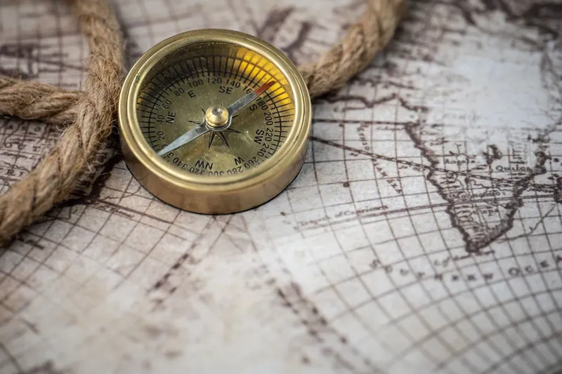
- Magnetic compass. A magnetized needle free to turn, aligning itself with the Earth's magnetic field. In China, lodestone was used in divination and geomancy before navigation. The scholar Shen Kuo described magnetized needles in his Dream Pool Essays of 1088, and he noted that they point slightly off true north, though he did not describe their use at sea. Zhu Yu's Pingzhou Table Talks, published in 1119, mentions ships' pilots on the southern coast, in the Guangzhou trade, using a needle for orientation in dark weather. In Europe, the English scholar Alexander Neckam wrote about a needle used by sailors around 1190. There was commercial contact between regions, but whether the compass was transmitted or invented more than once is still discussed.
- Chip log. A wooden board weighted to float upright was thrown astern on a line with knots tied at regular intervals while a sandglass timed the run. The number of knots that paid out gave the speed, and the unit we still call a knot descends from it. The first detailed English description dates to 1574.
- Octant and sextant. These use two mirrors to bring the image of a star down to the horizon, which makes the reading more accurate than earlier instruments and usable from a moving deck. The English mathematician John Hadley presented an octant to the Royal Society in 1731, and Thomas Godfrey of Philadelphia independently devised a similar instrument around 1730. The sextant proper, built of a larger arc for a wider range of angles, was made by John Bird in London in 1757.
Charts and portolans
Portolan charts show the Mediterranean and Black Sea and appear from the late thirteenth century. They are drawn with networks of rhumb lines radiating from points and mark ports and coastal features. They served for sailing from port to port, using the compass and estimated distances, and did not generally use latitude and longitude as maps do today. One of the oldest surviving examples, the Carte Pisane, is usually placed in the late thirteenth century, often given as about 1290 (estimates run from roughly 1275 to 1300), and is held in Paris.
Historical context
Navigating without instruments: the Pacific
Polynesian voyagers settled islands across an immense area of the Pacific, in successive waves over centuries, according to archaeological studies. The last major settlement, in New Zealand (Aotearoa), is usually placed around 1250 to 1300 CE. Navigators relied on a body of knowledge passed on orally. It included the points on the horizon where stars rise and set, the pattern of swells, the flight of land-nesting birds returning at dusk, and the color of the sky and clouds above islands. This tradition has been studied by anthropologists and by the communities themselves. It was revived in modern times, notably by the 1976 voyage of the canoe Hōkūle‘a from Maui, in Hawaii, to Tahiti, guided by the Micronesian navigator Mau Piailug of Satawal. It is a technology of orientation built on memory and observation, with no metal instrument involved.
The Mediterranean, the Islamic world and Atlantic routes
In the Islamic world, astronomers and instrument makers produced tables, astrolabes and treatises on their use, and Arab and Persian navigators in the Indian Ocean relied on knowledge of the monsoon winds and of the stars. Ahmad ibn Majid, a pilot from the Arabian coast, wrote navigational treatises in the later fifteenth century. During Portuguese and Spanish maritime expansion in the fifteenth and sixteenth centuries, navigators adapted instruments and astronomical tables, such as the almanac of Abraham Zacuto, to measure latitude in the middle of the Atlantic, while longitude remained unsolved.
The longitude problem
For centuries longitude errors caused drift and shipwrecks. In 1714 the British Parliament set up a Board of Longitude with a large prize for a practical method. Two lines of attack competed: the astronomical one, based on observing the Moon's position against the stars, and the mechanical one, based on precise clocks. John Harrison, an English clockmaker, built a series of marine timekeepers from the 1730s onward. The best known is the fourth, H4, finished in 1759 and tested on a voyage to Jamaica that left in November 1761 and arrived in January 1762, when it was only about five seconds slow after more than two months at sea. The Board asked for further trials, including a second voyage to Barbados in 1763 and 1764. The Board and Harrison disputed the prize for years, and he received the final payments only after appealing to King George III in the early 1770s.
The story is not a simple win for the clock. The lunar distance method was made practical by the Nautical Almanac, first issued for the year 1767, under Nevil Maskelyne, the Astronomer Royal. Makers such as Larcum Kendall, who built a copy of H4, and later Thomas Earnshaw and John Arnold made chronometers simpler and cheaper. From the late eighteenth century they gradually became available, and the two methods were used side by side for decades.
Impact and limitations
Instrument-based navigation allowed more regular ocean routes, growth in trade and more reliable maps. It was also bound up with colonization, the trade in enslaved people and struggles for power, which an honest account cannot leave out. The knowledge of non-European peoples, including Polynesian and Indian Ocean navigators, was long undervalued in narratives centered on Europe.
The technical limits persisted. An astrolabe or sextant needs a visible sky and a clear horizon, and a ship's motion adds error. The compass is subject to magnetic declination, the angle between magnetic north and true north, which varies with place and time, and it is disturbed by iron aboard ship, a growing problem with iron hulls in the nineteenth century. Dead reckoning accumulates error. Even with good clocks, storms, reefs and inaccurate charts kept causing wrecks.
Connections to other technologies
The practical astronomy and precision mechanisms involved have roots in ancient engineering, such as the Antikythera Mechanism. Marine clocks and instruments rely on gears and axles, the subject of the article on the wheel and rotating mechanisms. From the mid-nineteenth century, the telegraph let surveyors compare local times between distant stations, and with submarine cables it improved the measurement of longitude. In the early twentieth century, radio made it possible to broadcast time signals to ships and later supported radio navigation systems. Satellite systems such as GPS extend this history and are beyond the scope of this article.